Property Measurement Guide: How to Measure a Plot Accurately | Civil Engineer & Property Consultant in Seohara, District- Bijnor | House Map Planning in Seohara | 3D Elevation & Interior/Exterior Design in Seohara (Bijnor) | Property Buy & Sell in Seohara |
Understanding Property Measurements
Accurate property measurements are foundational in real estate, influencing various elements ranging from property valuation to development planning. Ensuring that these measurements are precise can significantly affect financial outcomes, investment decisions, and compliance with legal requirements. Among the common mistakes encountered in property measurements, inaccuracies can arise from miscalculation, misunderstanding of measurement units, or insufficient knowledge about the specific characteristics of the plot being measured.
Various units of measurement are used in real estate, the most common being square feet, acres, and square meters. Understanding these units is essential when assessing the total area of a plot, as different countries may employ different systems of measurement. For instance, while square feet are commonly used in the United States, many other countries adopt metric units such as square meters or hectares.
The significance of grasping the total area of a property extends beyond mere numbers. It is a critical factor in determining property value, as larger plots generally command higher prices. Additionally, developmental planning necessitates precise measurements to ensure that projects are feasible and compliant with zoning laws. For example, when planning a new construction or renovation, an accurate understanding of the plot size is essential to avoid encroachment on neighboring properties or violating building regulations.
Moreover, utilizing reliable tools for property measurement, such as the UA Map Studio Seohara, can reduce the occurrence of common measurement mistakes. The integration of technology in property measurement provides an efficient way to obtain accurate data, making the process less prone to human error.
Tools and Techniques for Measuring Property
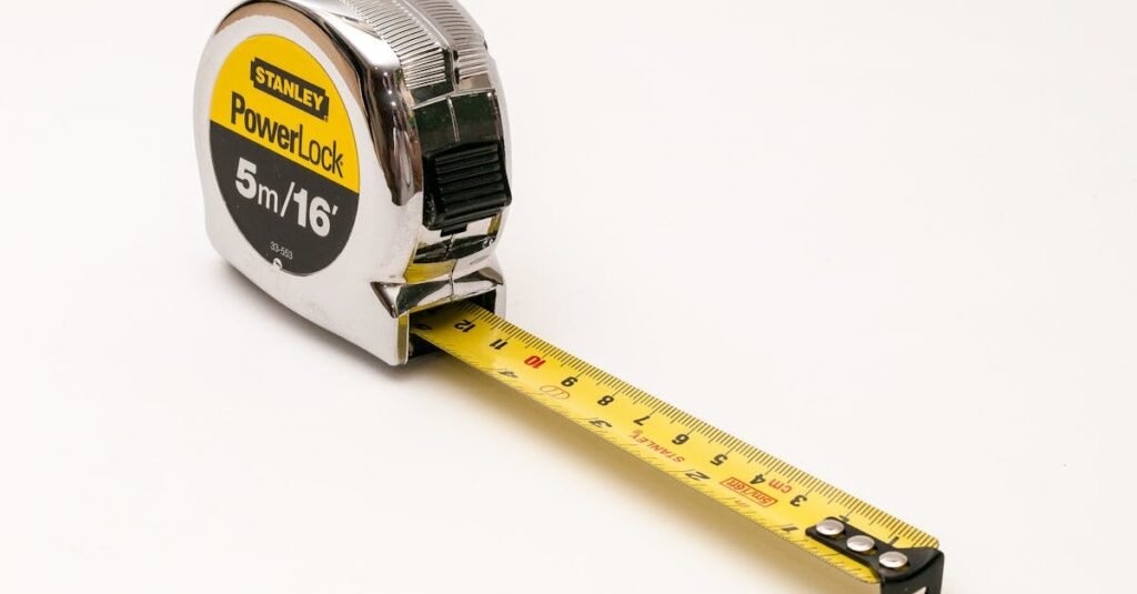
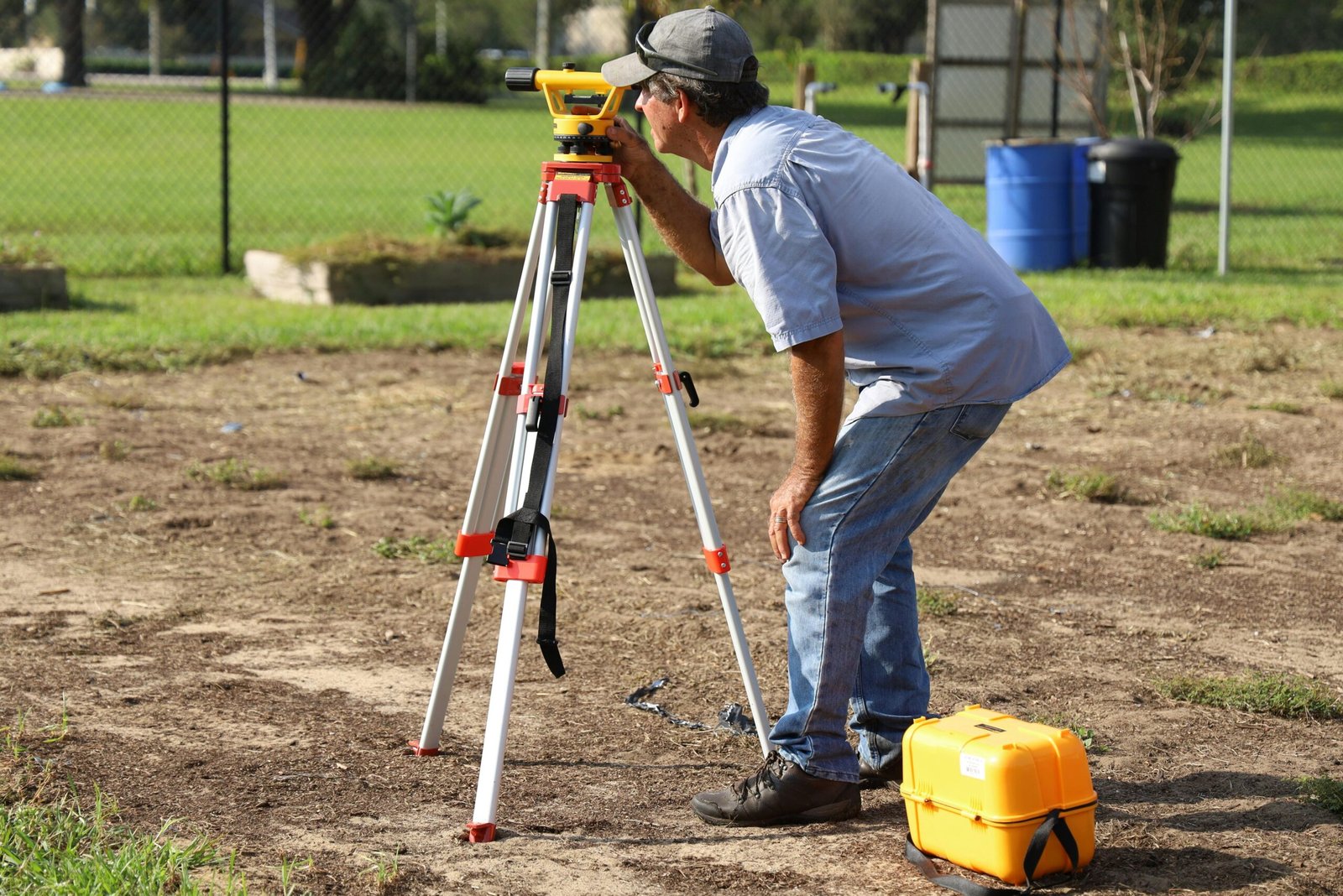
Accurate property measurement is essential for a variety of applications, from land development to boundary disputes. Understanding the measurement basics is crucial, and the tools and techniques employed play a significant role in ensuring reliability and precision. Among the traditional tools used for property measurement, tape measures and theodolites are often favored. Tape measures provide straightforward linear distance measurement and are best for small, accessible plots. Theodolites, on the other hand, allow for more complex angular measurements, making them valuable for establishing accurate boundaries on larger parcels of land.
In recent years, advancements in technology have introduced new methods that enhance measurement accuracy. GPS devices are a popular choice for surveying professionals as they offer real-time positioning data, allowing for efficient mapping of large areas. While GPS technology is advantageous, it is important to consider factors such as potential signal interference, which can affect accuracy in certain conditions.
Laser measuring tools have emerged as another modern alternative, offering quick and precise distance measurements. These devices utilize laser technology to calculate measurements with a high degree of accuracy, making them suitable for both indoor and outdoor use. However, users must be aware of limitations, such as the need for clear lines of sight and the potential impact of environmental factors like sunlight glare.
When choosing the appropriate technique for property measurement, it is critical to evaluate the specific needs of the project. Factors such as the size of the plot, environmental conditions, and desired measurement accuracy should all inform the selection of either traditional or modern tools. By understanding the strengths and limitations of available measurement techniques, individuals can avoid common mistakes and achieve more accurate property assessments. Ultimately, the right tool will enhance overall measurement reliability, contributing to successful property management and development outcomes.
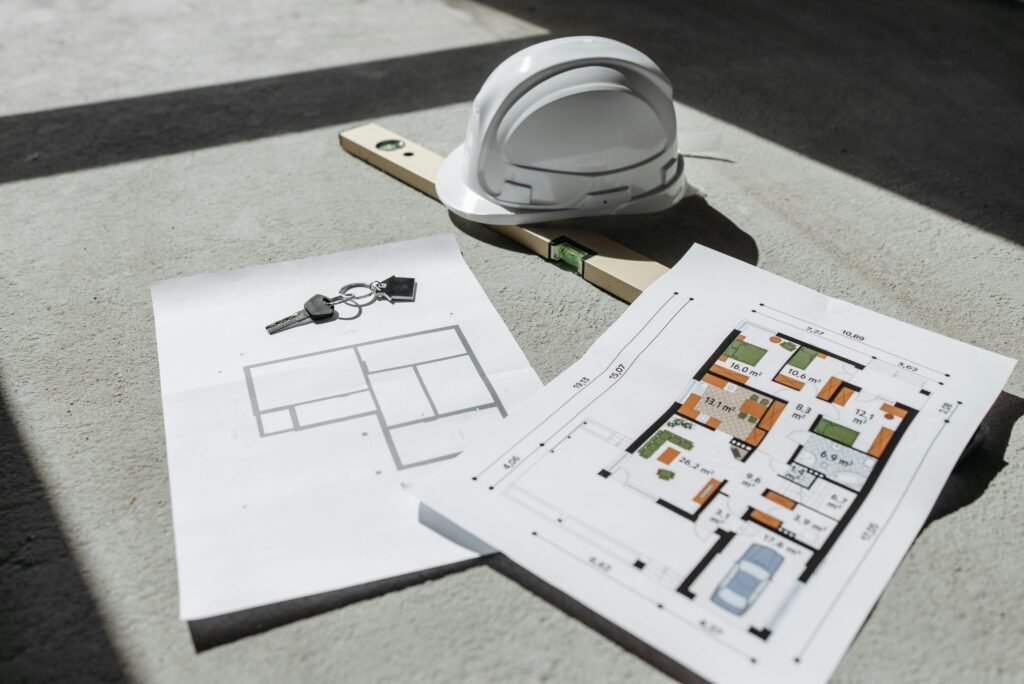
Property Measurement Guide-Step-by-Step
Accurate property measurement is essential for various purposes, such as boundaries determination, land use planning, or construction projects. Understanding the measurement basics is crucial to avoid common mistakes and ensure precise results. This guide outlines the necessary steps to achieve accurate measurements of your plot.
Begin by preparing the site for measurement. Clear the area of any debris, vegetation, or obstacles that could obstruct your measuring tools. It is advisable to gather tools such as measuring tapes, a level, and a digital or manual theodolite, depending on the complexity of the measurement task at hand. Establishing reference points is the subsequent step, which involves identifying fixed, unmovable landmarks around your property. Placing stakes or markers at each corner of the plot sets a clear framework for your measurements.
Once reference points are marked, proceed to take accurate measurements. Use a measuring tape or measuring wheel to measure the lengths of each side of the plot, ensuring that all measurements are taken from the same reference point to maintain consistency. When measuring irregular shapes, divide the plot into smaller sections or use grid methods to simplify the process. After collecting the measurements, it’s imperative to validate the results. Cross-reference measurements taken by different tools, for instance, using UA Map Studio Seohara can provide a technological edge in confirming accuracy.
As you undertake property measurement, safety precautions should not be overlooked. Wear appropriate gear and be vigilant about your surroundings, especially when working near roadways or construction sites. Incorporating best practices, such as double-checking measurements and utilizing trustworthy tools, will significantly enhance the accuracy of your property measurement, thus reducing the likelihood of common errors associated with the task.
Common Mistakes to Avoid When Measuring Property
Accurate property measurement is critical for various applications, including real estate transactions, construction projects, and land development. However, individuals often encounter several common mistakes that can lead to inaccuracies. Understanding these pitfalls can help ensure that measurements are executed correctly.
One frequent error is misreading measurements. This can occur when one relies solely on mechanical tools without verifying the readings or fails to double-check calculations. Any small error can result in significant discrepancies, especially over larger plots. It is advisable to use a reliable measuring device and to always record measurements multiple times for verification.
Another common mistake involves neglecting to account for irregular plot shapes. Many properties do not conform to simple geometric figures; therefore, measuring each side accurately is vital. Failing to account for zigzag patterns or skewed angles may lead to flawed calculations. Implementing measurement basics, such as breaking down the plot into manageable sections, can assist in achieving more precise results.
Additionally, overlooking local regulations or standards can result in significant complications down the line. Different regions may have specific guidelines governing measurement techniques, plot dimensions, and boundary definitions. Hence, before commencing measurement, it is key to familiarize oneself with the local laws that pertain to property measurements.
Finally, employing inadequate tools can lead to poor measurement accuracy. Utilizing specialized instruments such as the UA Map Studio Seohara can enhance measurement precision. This software aids in better visualization and can help mitigate human errors associated with traditional measuring tools. Awareness of these common mistakes can empower individuals to conduct more accurate property measurements, ultimately supporting their project goals.
Essential Property Measurement: Avoiding Common Mistakes
Understanding Measurement Basics
When it comes to property measurement, understanding the basics is crucial for accurately determining the dimensions of any plot. Proper measurements are essential for various purposes, including construction, landscaping, and real estate. Familiarizing yourself with the standard measurement techniques will lead to better outcomes.
Common Mistakes in Property Measurement
Many individuals make common mistakes when measuring a plot. One frequent error is not using the right tools, leading to inaccurate readings. Additionally, failing to establish reference points can result in discrepancies. It’s vital to double-check your measurements and always account for factors such as slope or obstacles on the property that may affect accuracy.
Tools You Need for Accurate Measurement
Equipping yourself with the right tools is paramount for precise measurements. A long measuring tape or a total station can significantly improve your accuracy. For larger plots, consider utilizing laser distance measurers, which provide quick and precise readings. Having these tools on hand will ensure you can effectively measure any property with confidence.
By mastering measurement basics, identifying common mistakes, and using appropriate tools, you can ensure accurate property measurements for your projects.
Need Help with Your House Plan or Property?
Don’t make costly mistakes while planning your home or buying property.
Get professional advice from a trusted Civil Engineer & Property Consultant in Seohara.
UA Map Studio Seohara, Dist- Bijnor
📞 Call Now: 9012584065
💬 WhatsApp Available